The Dawn of 'Opus-Class' AI: SpaceXAI Disrupts the Frontier with Grok 4.5 Silicon Valley — July 9, 2026 — In a move that has sent shockwaves through the artificial intelligence industry, Elon Musk’s tech company, SpaceXAI, officially released its highly anticipated next-generation model yesterday. Debuting on Wednesday, July 8, 2026, Grok 4.5 represents a massive leap forward in the frontier LLM landscape. Musk has boldly characterized the release as an "Opus-class model," a term reserved for systems that redefine the absolute limits of machine intelligence, reasoning, and multimodal synthesis. For months, the AI industry has grappled with the skyrocketing energy and financial costs of training and running frontier models. Yesterday's release addresses this bottleneck head-on, promising a cheaper, highly efficient alternative to the world's most powerful models without sacrificing the raw intellectual capabilities expected of a top-tier system. The Cor...
The Core Update: A Legacy of Service and Screen Iconography Passes at 80 In a solemn moment for both television history and the global first responder community, actor Randolph Mantooth, forever etched into the cultural fabric as the charismatic firefighter-paramedic Johnny Gage on the seminal 1970s drama Emergency! , has passed away at the age of 80. The news was confirmed today, Saturday, July 11, 2026, by his sister, Tonya Mantooth, in a statement to USA TODAY. Mantooth’s passing marks the end of an era for an actor who was far more than a prime-time star. Through his portrayal of Gage from 1972 to 1977, Mantooth did not merely entertain millions; he served as the public face of a revolution in emergency medical services (EMS). His death has prompted an outpouring of grief and remembrance from generations of firefighters, paramedics, and medical professionals who trace the very existence of their careers back to his work on the screen. The Root Cause of the Public Outpouring:...
Posted: Monday, July 06, 2026 Urgent Public Health Alert: Legionnaires’ Outbreak Strikes NYC’s Upper East Side, 14 Cases Confirmed New York City’s Upper East Side is currently grappling with a significant public health challenge as local health officials actively investigate a confirmed outbreak of Legionnaires’ disease. As of today, Monday, July 06, 2026, a total of 14 individuals have been sickened across several Upper East Side ZIP codes. Authorities are working diligently to pinpoint the precise source of the contamination, which remains elusive at this time. This emerging situation underscores the persistent threat posed by environmental pathogens, even in one of the world's most advanced urban centers. The Core Update: Navigating the Immediate Threat The revelation of 14 confirmed Legionnaires’ disease cases within a concentrated area of the Upper East Side has prompted an urgent response from the city’s health apparatus. The fact that the ...
Super Typhoon Bavi Unleashes Destructive Winds Across Guam and Pacific Islands
GoInfoGuide
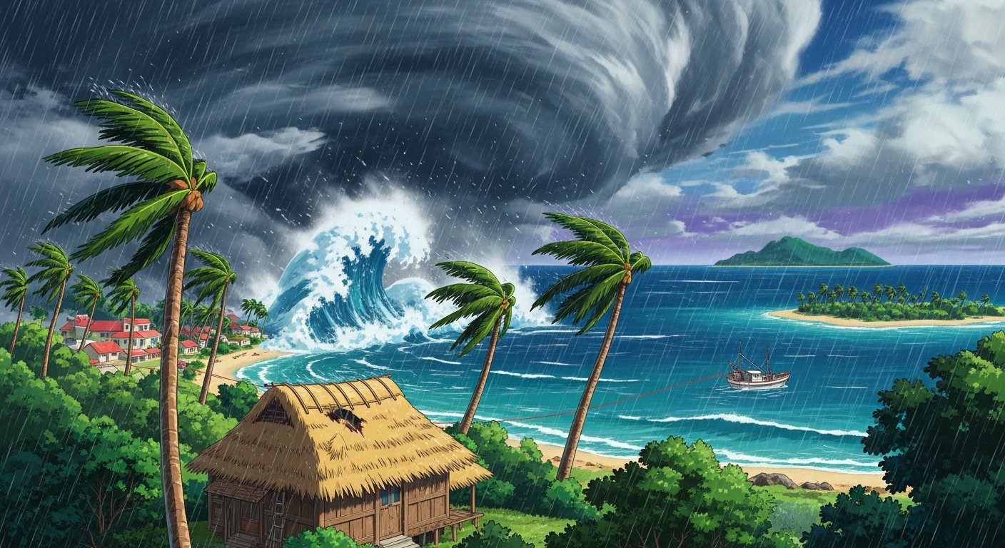
Super Typhoon Bavi Lashes Guam and Northern Mariana Islands with Destructive Winds and Flooding
PACIFIC BASIN — Residents across the Mariana Archipelago are hunkering down as Super Typhoon Bavi, a monstrous Category 5-equivalent storm, sweeps through the Western Pacific. The system is currently unleashing destructive, howling winds and triggering severe flooding across Guam and the Commonwealth of the Northern Mariana Islands (CNMI). Local authorities and meteorological agencies have placed the region under maximum alert, urging remaining residents to shelter in place as the eyewall of the storm moves dangerously close to the populated island chain.
According to regional emergency management officials, the impact of Bavi is already being felt acutely in the Northern Mariana Islands—remote U.S. territories situated in a highly active corridor of the Pacific Ocean. As the storm coordinates its path directly through the archipelago, emergency services are preparing for a protracted recovery phase, hampered by the extreme isolation of these islands.
The Core Update: Latest Conditions on the Ground
As of today, Monday, July 6, 2026, Super Typhoon Bavi is generating sustained winds that have paralyzed local infrastructure. The Northern Mariana Islands, including Saipan, Tinian, and Rota, are experiencing the brunt of the storm's eastern quadrant, which carries the most intense wind fields and torrential rainfall bands. Reports from the ground indicate widespread power outages, uprooted vegetation, and structural damage to non-reinforced buildings.
In addition to wind hazards, meteorological models highlight a severe risk of life-threatening storm surges and flash flooding. Because these remote U.S. territories rely heavily on vulnerable coastal roads and localized power grids, even minor storm surges can sever critical supply lines between municipal centers and isolated villages. Island governors have declared states of emergency, activating national guard units to assist with immediate search-and-rescue operations once the worst of the weather subsides.
Core Concepts: The Anatomy of a Western Pacific Super Typhoon
To understand the sheer scale of Super Typhoon Bavi, one must examine the unique atmospheric and oceanographic mechanics of the Western Pacific. Often referred to as the "warm pool" of the global ocean, this region features some of the deepest and warmest sea-surface temperatures on Earth. These warm waters act as high-octane fuel for tropical cyclones.
Thermal Updrafts and Low Pressure: As ocean temperatures exceed 28°C (82.4°F), rapid evaporation sends vast amounts of warm, moist air into the upper atmosphere. This creates a powerful low-pressure system at the surface, drawing in surrounding winds.
The Coriolis Effect and Rotational Velocity: Located in the tropical northern hemisphere, the spinning of the Earth forces these incoming winds to rotate counterclockwise, organizing the chaotic thunderstorms into a cohesive, rotating vortex.
Rapid Intensification: When vertical wind shear—the change in wind speed and direction with height—is low, the storm's central chimney can function unimpeded. This allows a cyclone to undergo rapid intensification, dropping central barometric pressure drastically within a 24-hour window, transforming a standard typhoon into a "Super Typhoon."
For Guam and the CNMI, their geographic alignment makes them a natural target. These islands are essentially the tips of underwater mountain ranges emerging from the deep Mariana Trench. With no significant landmasses nearby to disrupt the storm’s inflow or frictionally degrade its wind field, Super Typhoon Bavi was able to maintain its peak intensity right up to the point of impact.
Global Impact: Why the Mariana Islands Matter to the Rest of the World
While the immediate humanitarian crisis is localized to the residents of Guam and the Northern Mariana Islands, the ripple effects of a super typhoon in this sector of the Pacific have profound global implications. In today's highly interconnected global economy and geopolitical landscape, these remote outposts serve critical functions.
1. Military Readiness and Geopolitical Security
Guam is home to critical U.S. military installations, including Andersen Air Force Base and Naval Base Guam. These bases serve as the primary forward-operating hubs for the United States in the Indo-Pacific region. When a super typhoon like Bavi strikes, operational readiness is temporarily compromised. Ships must be sortied to sea to avoid harbor damage, aircraft are evacuated to safer airfields in Hawaii or Japan, and personnel are redirected to base defense and recovery. In an era of heightened regional tensions, any prolonged downtime at these installations draws close attention from global defense analysts.
2. Disruptions to Global Maritime Shipping Lanes
The waters surrounding the Mariana Islands form part of the primary shipping corridors connecting the manufacturing hubs of East Asia (such as Japan, South Korea, and China) with Australasia and the Americas. Mega-container vessels and oil tankers must reroute hundreds of miles to bypass the destructive wind radii of super typhoons. These detours introduce delays in global supply chains, driving up fuel consumption and shipping insurance premiums, which eventually manifest as higher consumer prices worldwide.
3. A Litmus Test for Climate Resilience
The ongoing situation in the Northern Mariana Islands serves as a crucial case study for coastal communities globally. As sea levels rise and ocean temperatures continue to set record highs, typhoons are projected to carry more moisture and retain their peak intensity further north. The performance of Guam’s hardened concrete infrastructure and underground utility grids during Bavi will provide vital data for urban planners and civil engineers designing resilient infrastructure in vulnerable coastal zones around the globe.
For now, the immediate focus remains on life safety. Emergency responders are urging everyone in the affected areas to remain indoors, stay away from windows, and monitor local emergency broadcasts. The coming days will reveal the true extent of Bavi's path of destruction, testing the resilience of these remote Pacific communities once again.
It seems there is something wrong with your internet connection. Please connect to the internet and start browsing again.
AdBlock Detected!
We have detected that you are using adblocking plugin in your browser. The revenue we earn by the advertisements is used to manage this website, we request you to whitelist our website in your adblocking plugin.
Site is Blocked
Sorry! This site is not available in your country.